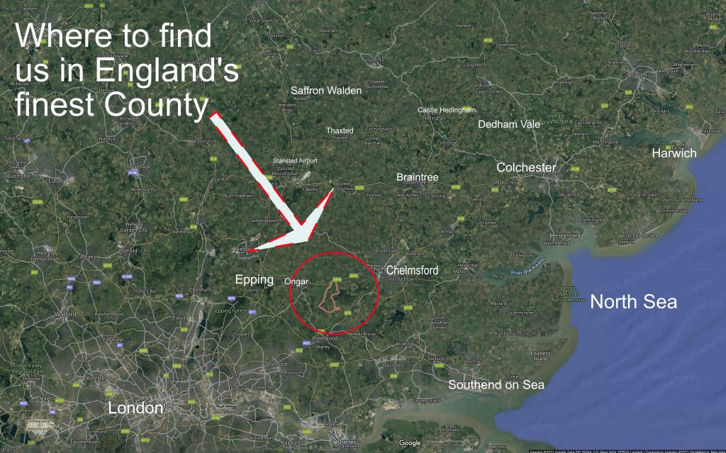
As an indication of its still rural and agricultural setting, no major highways intrude into our parish but we are still readily accessible by road.
Motorways serving the area are the M11 (junction 7) and M25 (junction 28). The A12 is the closest major route, leading to the A414 to our north and A128 to the south, each with feeder roads and lanes into the parish.
The nearest railway stations are at Ingatestone, Shenfield and Brentwood. Shenfield has a superior and more frequent timetable being a hub for East Anglia and other parts of Essex and is also the eastern terminus for the Elizabeth (Crossrail) link to central London. Unfortunately the station at Chipping Ongar no longer operates apart from heritage railway journeys to and from Epping.
Public transport is limited to Monday-Saturdays daytime buses: the 45 (Ongar, Blackmore village, Chelmsford); the 61 (Blackmore, Hook End Wyatts Green, Brentwood); 71 (Stondon Massey, Tipps Cross, Brentwood). Timetables and updated status of the running of these service is available at https://www.essexhighways.org/getting-around/bus.aspx
The closest airports with both national and international flights are Stansted and Southend both in Essex. Private aviation is available at Stapleford Abbots (Abridge) and North Weald.
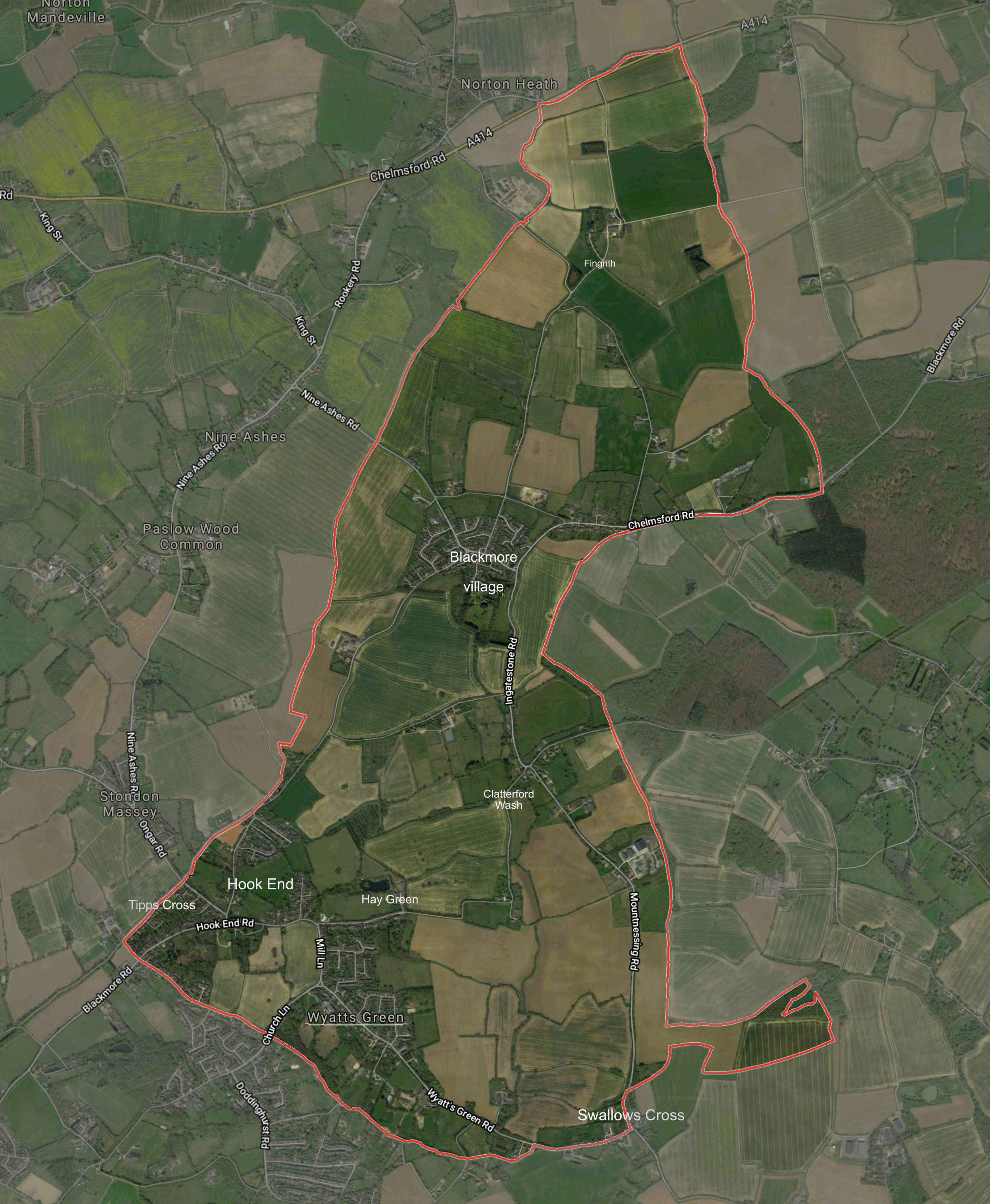
Blackmore, Hook End and Wyatts Green is a parish surrounded by other parishes and sits at the geographical junction of three district councils, Epping Forest, Chelmsford and Brentwood.
Parishes sharing our boundaries are Fryerning (with Ingatestone), Mountnessing, Doddinghurst, Kelvedon Hatch, Stondon Massey, High Ongar, Norton Mandeville, Willingale Spain and Highwood.
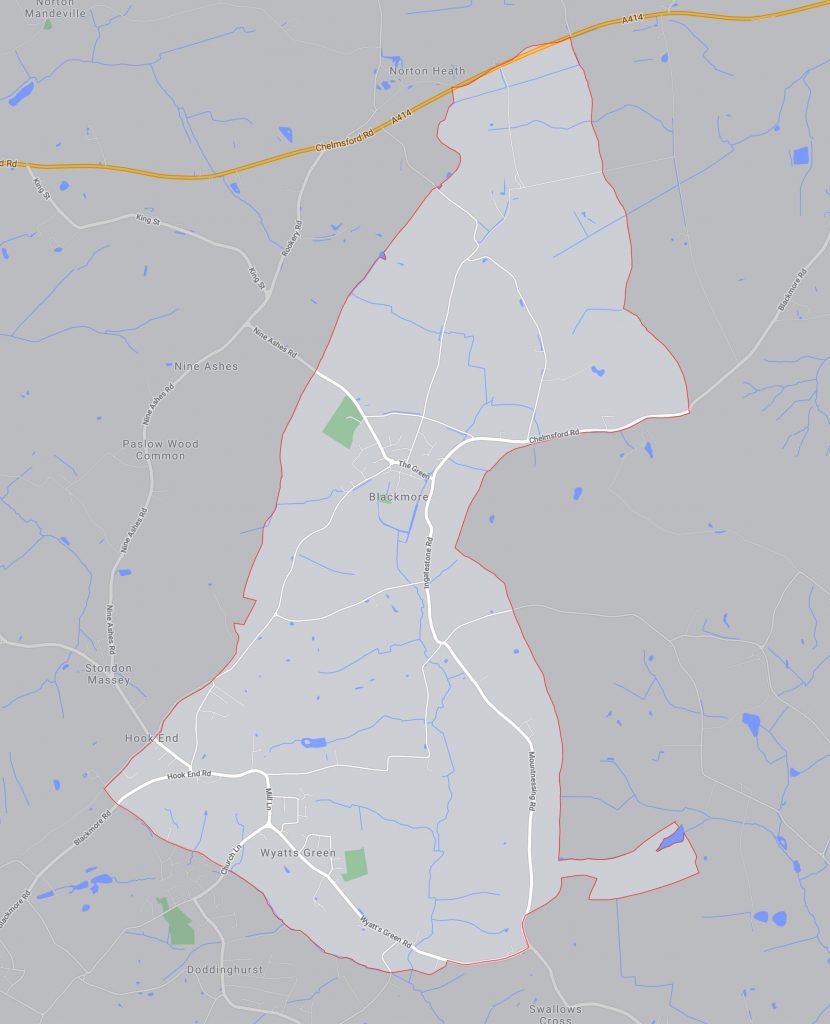
Map of the parish showing the main roads and waterways
Aerial image of the parish with its boundary marked in red. The larger settlements are named
One thought on “Our Location”
Neil McCarthy
Test
Comments are closed.